Unlock the Power of Location Intelligence
Scanning & Digital Documentation
Capture accurate, real-world conditions using 3D scanning, 360° imagery, and spatial documentation to support restoration, insurance, facility management, and decision-making.
Accurate Documentation of Real-World Conditions
Capture the exact condition of a site, space, or asset at a specific moment in time. Using 3D scanning, 360° imagery, and spatial mapping, we help organizations document damage, existing conditions, and site details with clarity and accuracy. These digital records support insurance claims, restoration planning, facility documentation, and long-term asset management.
What we Offer:
We deliver comprehensive scanning and digital documentation services that capture physical spaces as accurate, spatially referenced digital records. Our workflows combine 3D scans, floor-level mapping, 360° imagery, and GIS integration to create clear, organized documentation. Whether responding to an emergency, supporting insurance claims, or recording existing conditions, we provide reliable digital evidence that improves communication, transparency, and decision-making.
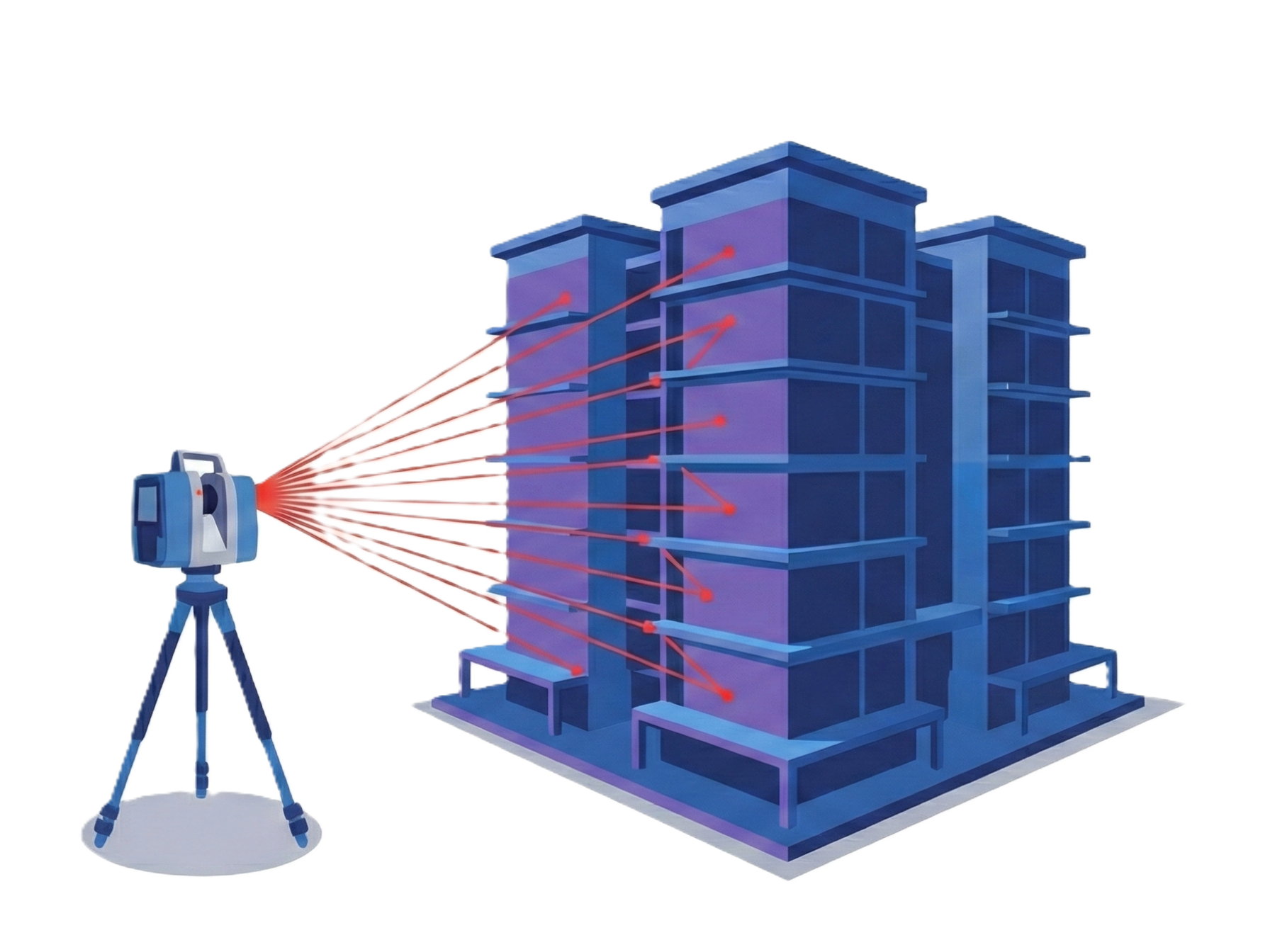
3D Scanning & Reality Capture
We capture high-accuracy 3D scans of interior and exterior spaces to document real-world conditions. These scans preserve geometry, dimensions, and spatial relationships, creating a reliable digital record. Ideal for post-incident documentation, renovation planning, and existing-condition surveys, 3D scanning reduces uncertainty and provides a trusted reference for teams and stakeholders.
Damage & Condition Documentation
We document damage caused by floods, fires, leaks, or structural issues using spatially organized records. Each affected room or area is mapped and linked with photos, notes, and observations. This structured documentation helps restoration and insurance teams clearly understand scope, severity, and location of damage, improving reporting accuracy and claim support.
360° Imagery & Visual Records
We capture immersive 360° imagery and link it directly to mapped locations inside buildings. These visual records allow teams to remotely review conditions, verify details, and reduce unnecessary site visits. 360° imagery enhances communication between insurers, adjusters, contractors, and facility teams by providing clear visual context tied to exact locations.
Digital Records & GIS Integration
All scanned data, imagery, and documentation are organized into a structured GIS environment. This allows users to navigate spaces by floor or room, search records, and connect documentation with indoor maps, assets, or digital twins. GIS integration ensures records remain accessible, organized, and reusable for future analysis, audits, or planning.
Key BEnefits:
Scanning & Digital Documentation provides accurate, spatially organized records that improve transparency, reduce disputes, and support faster, more confident decisions.
Capture accurate, verifiable site conditions
Improve insurance and restoration documentation
Reduce site visits through digital records
Maintain organized, location-based evidence
Support planning, audits, and future reference
Integrate seamlessly with GIS and indoor mapping systems
Industries We Support
Ventro Analytics
Transforming complex data into clear maps, dashboards, and digital twins.
Quick Links
Home
Solutions
Contact Us
About Us
Solutions
Geospatial Analysis & Reporting
Custom Applications
Drone Mapping & Remote Sensing
Indoors GIS & GeoBIM
Mapping and Cartography