Unlock the Power of Location Intelligence
Indoors GIS & GeoBIM Solutions
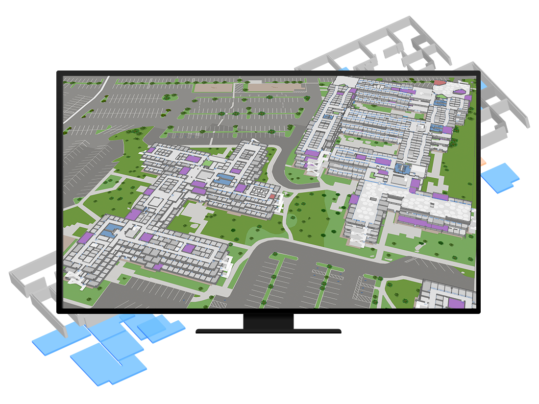
Digitize, map, and understand your buildings with indoor GIS and GeoBIM tools that improve planning, operations, asset management, renovations, safety, and emergency response.
A Smarter Way to Understand Your Buildings
Indoors GIS & GeoBIM solutions create a clear digital view of your spaces, assets, and building systems. By combining indoor maps, BIM data, 3D models, and floorplans, we help organizations improve planning, manage renovations, strengthen safety workflows, and document conditions with accuracy. These tools make it easy to explore, search, and manage your buildings in one unified digital environment.
What we Offer:
We build indoor GIS and GeoBIM systems that unify all your building information into one interactive platform. Our solutions combine GIS capabilities—such as spatial analysis, indoor navigation, and asset mapping—with CAD drawings, BIM models, floorplans, and emergency data. Whether you manage facilities, plan renovations, or support compliance and insurance, we deliver accurate digital tools that improve visibility and decision-making.
Indoor Mapping
We convert floorplans, CAD drawings, and building layouts into accurate indoor GIS maps. These searchable maps help your team locate rooms, pathways, assets, and structural elements. Ideal for facility management, multi-floor buildings, and complex environments, indoor mapping improves navigation, planning, and daily operations.
3D Building Models & Digital Twins
We create indoor digital twins and 3D models that represent your buildings accurately. Teams can explore floors, assets, and structures in an interactive environment, making it easier to plan upgrades, document conditions, support inspections, and improve lifecycle management. Digital twins offer a visual platform for operations and future planning.
Asset Mapping & Space Management
We map your indoor assets and spaces into a structured GIS database. Equipment, rooms, utilities, and infrastructure become easy to locate, track, and update. This service improves maintenance planning, reduces lost assets, enhances facility workflows, and supports efficient space management across multi-floor buildings.
BIM & GIS Integration for Construction
We integrate BIM and Revit models into your GIS system, allowing you to visualize construction and renovations with accuracy. This helps reduce material waste, avoid clashes before they occur, plan projects more efficiently, and understand the real condition of each space. Connected BIM data supports better cost control, communication, and long-term building documentation.
Safety, Compliance & Emergency Mapping
We map fire equipment, shutoffs, evacuation routes, alarms, and safety features to support compliance and emergency readiness. This helps teams respond faster, maintain accurate safety records, and perform inspections with clarity. Indoor GIS replaces outdated PDFs with live, searchable emergency maps accessible from anywhere.
Emergency Assessment & Insurance Documentation
Designed for restoration and insurance teams, this service documents indoor damage using mapped points, photos, and 360° imagery. After incidents such as fires or floods, every affected space can be captured and organized in a digital map. This provides accurate, location-based evidence for claims, reporting, restoration planning, and decision-making.
Key BEnefits:
Indoors GIS & GeoBIM solutions centralize your building data, making it easier to manage assets, renovations, safety workflows, and emergency documentation with confidence.
Centralize all indoor data in one system
Improve renovation planning and reduce material waste
Strengthen safety, compliance, and emergency readiness
Visualize buildings in 2D, 3D, and digital twin formats
Support maintenance and operational workflows
Enhance communication across teams and stakeholders
Industries We Support
Ventro Analytics
Transforming complex data into clear maps, dashboards, and digital twins.
Quick Links
Home
Solutions
Contact Us
About Us
Solutions
Geospatial Analysis & Reporting
Custom Applications
Drone Mapping & Remote Sensing
Indoors GIS & GeoBIM
Mapping and Cartography