Unlock the Power of Location Intelligence
Custom GIS Applications Development
Build powerful, map-based applications designed around your workflows, data, and industry. From web apps to real-time dashboards, we develop GIS solutions that improve efficiency, communication, and decision-making across your organization.
Your Data. Your Workflows. Your Custom GIS App.
Our custom GIS applications turn your data into intuitive tools your team can use every day. Whether you need a web mapping application, a tailored dashboard, or a multi-floor facility viewer, we build solutions that match how you work — not the other way around.
What we Offer:
We create fully customized GIS applications using the latest Esri technologies, designed to support your exact workflows and business needs. Our solutions integrate maps, dashboards, analytics, 3D models, and field data into one seamless digital experience. With a focus on performance, clarity, and usability, we deliver applications that help your team work smarter and make confident, data-driven decisions.
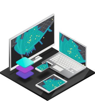
Custom Web Mapping Applications
We build interactive web mapping applications tailored to your operational needs. These apps allow your team to visualize data, toggle layers, run analysis, and access information from any device. With user-friendly interfaces and advanced GIS functionality, your application becomes a central tool for planning, field coordination, and everyday decision-making.
Interactive Dashboards
Transform your data into real-time dashboards that combine maps, charts, and analytics in one view. We design dashboards optimized for performance and clarity, helping you monitor trends, track progress, and make fast operational decisions. Whether you manage assets, facilities, or field operations, your dashboard becomes your single source of truth.
Field Data Collection Apps
Reveal hidden patterns in your data using advanced spatial analysis. We map historical and current information to uncover trends in performance, demand, travel, or operations. This helps you predict future needs, improve planning, and act before issues escalate. Turn complex datasets into actionable insights that guide long-term strategy.
3d GIS & Digital Twin Applications
Build immersive 3D experiences that bring your buildings, sites, and assets to life. Our 3D applications integrate BIM, CAD, drone scans, and IoT sensors to create realistic digital environments. Users can explore structures, monitor assets, and visualize changes over time, enabling better planning, documentation, and communication.
Indoor Mapping Applications
We create indoor GIS applications that visualize rooms, equipment, assets, and multi-floor navigation inside your buildings. These apps support maintenance teams, facility managers, emergency responders, and construction workflows by bringing indoor data into an interactive, searchable interface. Floorplans, assets, and 3D models become easy to explore and manage.
Automated Reporting & Analysis Tools
We build automated reporting tools that generate insights using your live GIS data. Whether you need cost breakdowns, risk assessments, travel analysis, or performance metrics, your application can automatically produce clean reports on demand. These tools reduce manual work, eliminate errors, and ensure consistent, data-driven decision-making.
Key BEnefits:
Our custom GIS applications give your organization a powerful, tailored platform that improves visibility, efficiency, and decision-making. Everything is built around your data, goals, and workflows.
Applications designed specifically for your operations
Real-time access to live, accurate geospatial data
Improved communication and team collaboration
Faster and smarter decision-making through interactive tools
Reduced manual work through automation and integrations
Scalable solutions that grow with your organization
Industries We Support
Ventro Analytics
Transforming complex data into clear maps, dashboards, and digital twins.
Quick Links
Home
Solutions
Contact Us
About Us
Solutions
Geospatial Analysis & Reporting
Custom Applications
Drone Mapping & Remote Sensing
Indoors GIS & GeoBIM
Mapping and Cartography